
In this episode, I talk with Rex Hansen, Principal Product Manager for the ArcGIS Maps SDKs for Native Apps and ArcGIS Maps SDKs for Game Engines at Esri, In this episode, I talk with Rex Hansen, about how immersive digital twins in AEC are revolutionizing the way we plan.
Engineering Quotes:
Here Are Some of the Questions I Asked Rex:
- Can you explain what GIS and SDK stand for and how they work together?
- How did the idea of using game engines with GIS come about, and how is that helping create immersive digital twins in AEC?
- Can you share some real-world examples of how AEC professionals are using ArcGIS Maps SDKs for planning, visualization, or client engagement?
- How do your SDKs help AEC teams access geospatial data in low-connectivity environments or with offline access?
- How are tools like Unreal Engine and Unity starting to use real-world sensor or IoT data, and how does that improve communication compared to traditional CAD or BIM?
- How can combining GIS with game engines support smart cities and better infrastructure planning at a large scale?
- What upcoming AEC technology trends in GIS and immersive technology are you most excited about over the next five to ten years?
- What advice would you give AEC professionals who want to stay ahead as geospatial technology and immersive design keep evolving?
Here Are Some Key Points Discussed in This Episode About Immersive Digital Twins in AEC: Revolutionizing Infrastructure with GIS and Game Engines:
- GIS stands for Geographic Information System and is used to capture, manage, and analyze both 2D and 3D geospatial data. SDKs, or Software Development Kits, provide developers with the tools to build custom applications that bring GIS data to life in interactive environments.
- The rise of mixed reality tools sparked interest in merging geospatial data with real-time visualization. AEC professionals now use game engines to create immersive digital twins in AEC workflows that improve communication and stakeholder engagement.
- Firms such as Halcyon Levine are using ArcGIS Maps SDKs with Unreal Engine to transform city planning into interactive, visual experiences. Their work in St. Louis shows how digital twins can support community input, attract investment, and guide redevelopment projects.
- ArcGIS Maps SDKs allow users to download and store 3D data locally so they can access information without a live connection. This makes it possible for field teams to view and interact with accurate geospatial models in low-connectivity environments.
- Unreal and Unity now support integration with IoT and real-time sensor data, allowing users to see dynamic environments that reflect real conditions. These tools reduce the need for interpretation by presenting accurate, visual information that mirrors what is happening in the real world.
- GIS and game engine integration enables the creation of digital ecosystems that can be explored in detail by planners, policymakers, and the public. Applications like UrbanXR allow for collaborative urban design and immersive decision-making.
- Trends such as GIS-BIM integration, high-resolution 3D capture, AI-driven insights, and wearable XR technology are reshaping how the AEC industry works. These AEC technology trends improve accuracy, enable real-time planning, and enhance the way teams visualize and simulate future projects.
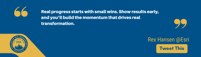
- AEC professionals benefit by starting with a strong GIS foundation and gaining familiarity with game engine technology. Progress comes from learning through small wins, showing value early, and building solutions that work for both technical and non-technical users.
More Details in This Episode…
About Rex Hansen
 Rex Hansen is a principal product manager at Esri, where he leads the development of ArcGIS Maps SDKs for Native Apps and Game Engines. With over 30 years of experience in GIS, spatial analytics, and computer mapping, Rex specializes in empowering developers to build high-performance, immersive applications using real-world geospatial data. His work includes enabling offline workflows, photorealistic visualization, and XR solutions across platforms like .NET, Kotlin, Swift, Unity, and Unreal Engine. A University of Arizona alumnus, Rex is also an advocate for immersive digital twins in AEC, particularly their role in smart city development, infrastructure planning, and XR visualization.
About the Host: Nick Heim, P.E.
 Nick Heim, P.E., is a civil engineer with seven years of experience in the repair and restoration of existing structures and the host of the AEC AI & Tech Strategy Podcast (“AECT”), where he brings valuable insights and expertise to listeners worldwide.
Nick’s interests lie at the intersection between the built world and technology, and he can be found looking for the ever-changing answer to the question, “How can we do this better?” Nick can be found on LinkedIn, producing content about the use of technologies in his civil engineering career and small business.
Sources/References:
Esri
3D Workflows
Worlds with ArcGIS and Unreal Engine | Unreal Fest 2024
ArcGIS Maps SDKs for Game Engines
Optics 3D Active Digital Twin ArcGIS Unity Gaming Engine
JetBrains
Flutter
Connect with Rex Hansen on LinkedIn
AEC PM Certification
AEC PM Connect
Project Management Accelerator™
Engineering Leadership Accelerator™
Keynote Speaking
Please leave your comments, feedback, or questions in the section below.


